Search Demo: Museum Collection
Explore ElasticPress' search and faceting capabilities with the catalog of the Cooper-Hewitt Museum.
You can also get more detail on specific features by clicking the ElasticPress logos (![]() ) located around the page.
) located around the page.
-

Map Sampler, An Outline Map of the World for Ladies Needlework and Young Students of Geography, 1798
A map sampler of the world showing the two hemispheres, labeled Western Hemisphere or New World and Eastern Hemisphere or Old World.
-

Map Sampler, Embroidered Map, 1939
The globe shown in two hemispheres, showing the flights of Colonel and Mrs. Lindberg in 1931, 1933 and 1937. There are scenes in each corner labeled S. America, Africa, China,…
-

Map Sampler (England), late 18th century
Embroidery on top of printed satin foundation of two globes of the world. Printing on satin reads: “The World with all modern boundaries.” Elaborate border of embroidered flowers and ribbons.
-

Map Sampler (England), ca. 1790
Map showing all the countries of England and Wales, with portions of Scotland, Ireland and France. Embroidered inscription at top: “South Britain is divided into 62 counties 40 of which…
-

Map Sampler (England), 1797
Map of England and Wales with surrounding waters on which are ships with sailors.
-

Map Sampler (England), 1784
Europe with names of countries and bodies of water in embroidery. Upper corner reads “A Map of Europe by Jane Flint 1784.” Lower margin has alphabet.
-

Map Sampler (England), late 18th century
Globe showing North and South America with figures representing colonists and a Native American Indian. Surrounded by flowering sprays tied with tasseled ribbon.
-

Map Sampler (England), 1824
An embroidered map of the world shown as two tangent hemispheres. A banner floats above with Eastern Hemisphere Western and yellow roses. With inscription center bottom.
-
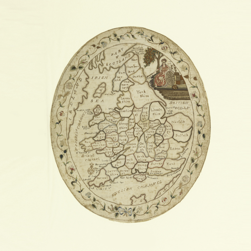
Map Sampler, A Map of England and Wales, late 18th century
Oval map sampler of England and Wales, with the counties outlined and identified. With a portrait of Britannia in the upper right, and a flowering vine border.
-

Map Sampler (England), ca. 1780
A signed map of England and Wales in very poor condition.
Search Collection
Country
Object Type
Color